 Hundreds of water bodies and small rivers in the greater Sylhet region are already facing a water crisis during the dry season, even before India’s contentious Tipaimukh dam project in Manipur has taken off in the upstream, according to Bangladesh Water Development Board.
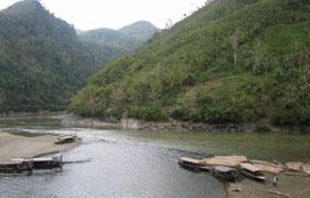
WDB officials said a huge shoal emerges every dry season, November to April, at the mouth of the Surma river that is fed by the cross-border Barak river, over which the Indian government is planning to build its dam.
“The large shoal has been surfacing at the mouth of the Surma, at Amalshid, every dry season for some years past,” Abul Kalam Mohd Azad, BWDB director general, told bdnews24.com on August 9.
“We have been trying to dredge the river-mouth to ease the river’s flow,” he said.
But water board officials say they cannot clear the shoal since it lies in the “no-man’s-land” on the Bangladesh-India border in Sylhet.
They say Delhi is yet to give Dhaka the green signal to dredge the river’s mouth at Amalshid in Sylhet.
The common river Barak enters Bangladesh through Amalshid bifurcating into the Surma and the Kushiara.
Because of the shoal at the Surma’s mouth, the Barak waters now mainly drain through the Kushiara, rendering the Surma-dependent areas water-thirsty.
The Surma criss-crosses the Sylhet and Sunamganj districts. Millions of farmers and fishermen are solely dependent on the water bodies and distributaries of the Surma for their livelihood.
“Hundreds of large and small rivers and other open water bodies in Sylhet and Sunamganj districts are fed by the Surma,” Syed Ahsan Ali, a superintendent engineer of the Water Development Board in Sylhet, told bdnews24.com.
“In the dry season, the water bodies and the distributaries face water shortages as the shoal diverts waters to the Kushiara which now carries 80 percent of the Barak waters.”
Syed Ahsan Ali was authorised to talk to bdnews24.com by the board’s chief of planning Md Saidur Rahman.
Rahman told bdnews24.com, “We have requested the Indian government to undertake dredging in the Surma river.”
BWDB director general said the shoal must be cleared as soon as possible, or massive silt deposits may soon choke the whole river.
Surma flow data reveals a grim picture of the Surma river in the lean period (November to April) at Kanaighat, the Bangladesh Water Development Board’s nearest observation point to the shared border with India.
In 2006, the Surma’s flow at Kanaighat in the dry season was 9.18 cumec per second in April while the lowest was 4.56 cumec per second on February 13. The same river’s highest flow at the same point was 1416 cumec per second on July 10 and the lowest 670 cumec per second in August.
The Surma’s highest and lowest flows in the lean period in 2007 were recorded in March. The highest flow in the dry season was just 4.6 cumec per second and the lowest 4.22 cumec per second. The same river’s highest and lowest flows figures in the 2007rainy season were recorded in August. They were 962 cumec per second and 670 cumec per second.
In 2008, the Surma’s highest and lowest flow figures for the dry season were both recorded in March. The lowest flow was 6.05 cumec per second while the highest was just 15 cumec per second. The highest flow in the rainy season the same year was 1456 cumec per second on July 21.
The figures for 2009 are yet to be processed, said officials.
Environmentalists in India and Bangladesh say the proposed Tipaimukh dam, on top of the prevailing situation, will certainly cause “environmental disaster” both in the upstream and downstream—despite repeated assurances by Delhi that it will not.
Foreign minister Dipu Moni, who is scheduled to visit India in September, told bdnews24.com on August 12, “I will discuss this further with the Indian government”.
However, Sajjad Hossain, a member of the Joint Rivers Commission, which discusses river-related issues with India, refused to comment on the issue, when approached on Friday, telling bdnews24.com, “I have nothing to say”.
Source: BDNEWS